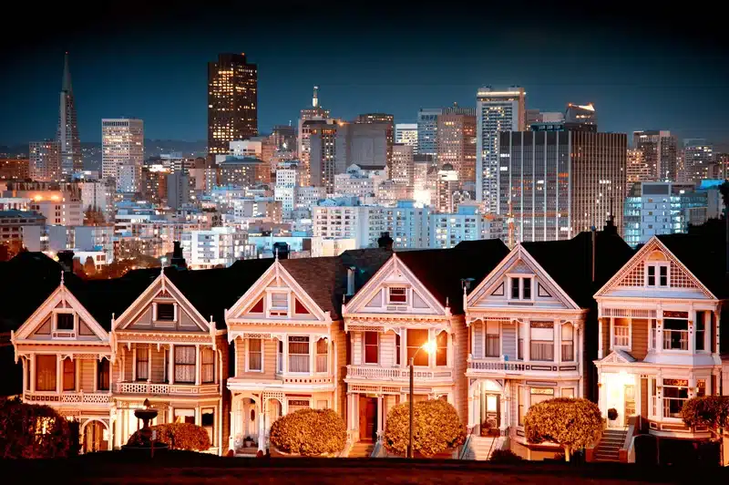
San Francisco stands out with its 89 unique neighborhoods that make it one of the most diverse cities that ever spread across America. Each neighborhood has its own story to tell. The fog-wrapped streets of the Outer Sunset and the vibrant cultural scene of the Mission District make finding the best neighborhoods in San Francisco an incredible experience.
The city shows its competitive spirit with a median home price of $1.7 million, yet each district brings something special to the table. Noe Valley’s sunny slopes create a beautiful contrast with the Castro’s historic LGBTQ+ community, and the Embarcadero draws people in with its famous Ferry Building Marketplace. The city’s microclimates create unique weather patterns that shape each neighborhood’s character.
This San Francisco neighborhood guide will help you understand what makes each San Francisco district special, from its authentic charm to its cultural significance in this remarkable city.
The Story Behind San Francisco’s Districts
San Francisco’s neighborhood story began in 1848 when James Marshall found that there were gold flakes at a lumber mill. This discovery sparked one of the largest migrations in U.S. history. The original San Francisco was just a tiny settlement of 1,000 residents. The California Gold Rush reshaped the scene and turned it into a bustling port town. The population skyrocketed to 25,000 by 1849.
From Gold Rush to Tech Boom
Waves of settlers poured into the city to seek their fortune. San Francisco’s population jumped to 56,802 by 1860, reached 149,473 by 1870, and grew to 342,782 by 1900. The city built its first public school district during this time and saw the birth of iconic businesses such as Levi Strauss & Co.
San Francisco’s evolution from Gold Rush boomtown to modern metropolis took another dramatic turn as tech companies moved in. The South of Market (SoMa) district grew from an industrial area into a thriving tech hub. This change brought great prosperity but created new challenges. Real estate prices soared and many neighborhoods saw major demographic shifts.
How neighborhoods got their names
San Francisco’s district names tell stories of its rich history and cultural importance. Natural features inspired some neighborhood names. A lone poplar tree (“alamo” in Spanish) gave Alamo Square its identity. Notable figures left their mark on other areas:
- Haight Street – Bears the name of Henry Haight, who arrived in 1850 and became governor
- Castro Street – Honors Jose Antonio Castro, a Mexican military commander
- Noe Valley – Remembers Jose de Jesus Noe, who got the land from Mexico’s governor in 1846
Simple observations named some areas. Dairy farms dominated Cow Hollow, with 38 farms at its peak in 1880. Gold Rush settlers found that there was a cemetery with Russian inscriptions on top of what became Russian Hill. Chinatown, which started in the 1850s, kept its name after several other attempts.
Understanding San Francisco’s Layout
San Francisco sits on 48 distinct hills that shape its neighborhoods and create a remarkable urban setting. Natural geography and thoughtful urban planning blend together to give each area its own identity.
The seven hills
The city’s historic foundations rest on seven original hills among the 48 named elevations. These landmark hills are Nob Hill, Russian Hill, Telegraph Hill, Rincon Hill, Twin Peaks, Mount Sutro, and Mount Davidson. Mount Davidson stands as the highest natural point at 928 feet. Twin Peaks reaches 922 feet and rewards visitors with spectacular views across the city. Nob Hill became famous as the neighborhood where 19th-century tycoons built their mansions, though the 1906 earthquake destroyed most of them.
Main district divisions
The city breaks down into 11 distinct supervisorial districts, each with its own personality and neighborhood mix. The San Francisco Planning Department recognizes 36 official neighborhoods within these districts. District 3 covers the lively areas of North Beach, Chinatown, and the Financial District. District 8 features the energetic Castro and the relaxed Noe Valley.
Neighborhood boundaries
The Mayor’s Office of Neighborhood Services established general guidelines for neighborhood boundaries in 2006, rather than strict borders. These boundaries help organize city services and community planning, though residents and visitors often see the neighborhood limits differently. Some neighborhoods have earned special status as cultural districts to protect their heritage and character.
The city follows five broad districts that match geographical quadrants – Central/downtown, Richmond, Sunset, Upper Market (south central), and Bernal Heights/Bayview (southeast). These larger divisions contain smaller subsections and developments that create an array of distinctive San Francisco neighborhoods.
San Francisco’s Famous Neighborhoods
San Francisco’s array of districts features three neighborhoods that serve as cultural anchors. Each preserves its unique heritage while adapting to modern times.
North Beach and Italian heritage
Little Italy, as North Beach is fondly called, keeps its Italian roots alive through sidewalk trattorias and historic cafes. The neighborhood’s cultural impact goes beyond its Italian heritage. Francis Ford Coppola wrote the Godfather screenplay at Caffe Trieste, making it a significant cultural landmark. Saints Peter and Paul Church towers over Washington Square. Pizzerias, coffee houses, and aromatic delicatessens line Columbus Avenue.
Chinatown’s cultural significance
San Francisco’s Chinatown, 170 years old, stands as North America’s oldest such district and the largest outside Asia. The neighborhood stretches 30 blocks from its iconic gate at Grant and Bush streets, packed with cultural treasures. The 1906 earthquake brought unexpected opportunities despite destroying thousands of homes and businesses. Lost immigration records allowed many Chinese residents to claim citizenship and bring their families to America.
Chinatown showed remarkable resilience. People from different regions of China moved in after the earthquake. Today, the neighborhood maintains its cultural independence through:
- Chinese Culture Center showcasing heritage through street art since 1965
- Chinese Historical Society Museum housing over 22,000 artifacts
- Traditional temples and markets preserving authentic community life
The Mission’s Latino roots
Gold Rush miners from Mexico, Chile, and Peru created the city’s first Latin Quarter in what became the Mission District. The neighborhood’s current identity emerged in the 1930s when Bay Bridge construction forced Latino residents to relocate from Rincon Annex.
Community strength peaked through resistance to urban renewal in the 1960s. Residents formed the Mission Coalition Organization when city plans threatened to change the area with high-rises. They created block clubs ready for action. Their successful fight against redevelopment saved the neighborhood’s character and created important institutions like the Mission Hiring Hall.
The Mission remains a vibrant cultural hub despite modern challenges. The Latino population has grown across the city while declining in the Mission, dropping from 40.5% to 34.7% between 2010 and 2020. Latino culture runs strong along Mission Street from 22nd Street to Cesar Chavez and down Calle 24. This area earned the title ‘Latino Cultural District’ to protect its distinctive heritage.
Best San Francisco Neighborhoods
San Francisco’s hidden treasures lie beyond the tourist-packed streets of Fisherman’s Wharf and the iconic slopes of Nob Hill. These neighborhoods offer authentic experiences and unique charm.
Lesser-known areas
The Outer Sunset serves as a surfer’s paradise where fog-wrapped streets meet the Pacific. This former “Outside Lands” area has transformed from sand dunes into a vibrant community with colorful cafes and the historic Balboa Theater. Built in 1926, the theater stands as one of the city’s last neighborhood cinemas. Balboa Street’s stretch between 30th and 40th Avenue showcases acclaimed restaurants and beautiful sidewalk landscaping.
The Glen Park district tells stories of San Francisco’s rural past through its historic country roads. Three remarkable paths connect the neighborhood – Poppy Lane, Penny Lane, and Ohlone Way – each offering glimpses of the area’s dairy farm heritage. Ohlone Way runs between Surrey and Sussex streets and fascinates visitors with its wide paths, old brickwork, and rich landscaping that ranges from cacti to fragrant lavender.
The Sunset District holds architectural treasures many people miss. Depression-era architect Oliver Rousseau created storybook homes between Kirkham and Lawton streets, from 33rd to 36th avenues. These homes blend Spanish, Tudor, and Parisian influences with whimsical elements like terraces and cupolas.
Up-and-coming neighborhoods
Dogpatch has evolved from an industrial hub into an artistic haven. Young professionals and families flock to its art galleries, breweries, and trendy restaurants. New waterfront developments and modern living spaces mark the neighborhood’s evolution.
Potrero Hill shines as a rising star with stunning views and vibrant nightlife. Victorian homes mix with modern condos while the area keeps its neighborhood charm despite being close to downtown. Local favorites define its food scene – from the charming Chez Maman’s French cuisine to Goat Hill Pizza’s San Francisco sourdough crusts.
The Outer Mission draws young families and entrepreneurs with its affordable housing and multicultural heritage. A strong sense of community runs through this district where Italian, Irish, Asian, Pacific Islander, and Latino cultures blend seamlessly.
Visitacion Valley proudly stands as the country’s first Pacific Island Cultural District. Meanwhile, the Excelsior neighborhood, nicknamed ‘the Queens of San Francisco,’ keeps its family-oriented spirit alive through diverse small businesses.
Weather and Microclimates
The weather between the Pacific Ocean and San Francisco Bay creates an interesting puzzle that shapes life in the city’s neighborhoods. A maritime climate keeps temperatures moderate throughout the year. The temperature stays between 45°F to 72°F, which makes each district a great place to live.
The fog effect
The city’s famous fog, nicknamed Karl, performs a daily dance across neighborhoods. It first appears offshore around 2:30 PM and rolls through the Golden Gate. The fog spreads across the bay and sometimes reaches the Berkeley Hills. The western neighborhoods feel this natural phenomenon the most. The Sunset and Richmond districts see more fog than other areas.
Summer months bring a predictable fog pattern. The outer neighborhoods near the ocean start cool and foggy in the mid-50s. The fog burns off around 10 AM. These areas then enjoy sunny skies and temperatures in the low 60s until about 3 PM. Cool ocean winds bring the fog back afterward.
Best weather spots
The city’s unique layout creates distinct temperature patterns in different neighborhoods. Temperatures can differ by up to 21 degrees within just five miles. The Mission District and Potrero Hill sit sheltered by the city’s hills on the eastern side. These areas usually enjoy the warmest and sunniest weather.
Here’s how the seasonal temperatures vary across San Francisco:
- Spring (March-May): 63°F high, 48°F low
- Summer (June-August): 71°F high, 55°F low
- Fall (September-November): 70°F high, 53°F low
- Winter (December-February): 57°F high, 44°F low
These microclimates substantially affect real estate values. Sunny areas cost about 20% more than foggy districts. The contrast between neighborhoods can be striking. The Castro District might bask in warm sunshine while the Sunset District sits wrapped in chilly fog.
Fall stands out as one of the nicest seasons, with September highs averaging 71°F. This time brings relief from summer fog patterns. It’s perfect to learn about different neighborhoods. The city’s location, with water on three sides, creates these distinct weather patterns that give each neighborhood its character.
Golden Gate Park shows how microclimates work. It often runs seven degrees cooler than nearby neighborhoods. These weather variations help create each district’s unique personality. You can see it in everything from the fog-wrapped streets of the Outer Sunset to the sun-soaked sidewalks of the Mission District.
Transportation Between Districts
San Francisco’s districts are easy to navigate with a mix of traditional public transit and active transportation choices. The city’s network makes neighborhood exploration both convenient and affordable.
BART and Muni routes
The Bay Area Rapid Transit (BART) system forms the backbone of San Francisco’s public transportation. It connects downtown with surrounding areas through all-electric trains. A one-way BART fare from SFO to downtown costs $11.15, making it a cost-effective choice for longer trips.
The San Francisco Municipal Transportation Agency (SFMTA) runs Muni, a network of fuel-efficient busses, light rail Metro trains, historic streetcars, and iconic cable cars. Downtown-Union Square has the highest transit score of 100, with access to 21 bus lines, four subway lines, and six light rail options. The Financial District maintains a strong connection through 64 bus lines, four subway lines, one cable car line, and seven light rail routes.
The historic cable car system runs on three main lines:
- Powell-Hyde
- Powell-Mason
- California Street
The F-Line streetcar adds character to the city’s transit mix and travels along Market Street to Fisherman’s Wharf. Cable cars and streetcars accept Clipper Cards for payment, which combines smoothly with other transit options.
Walking and biking options
Walking is a great way to discover San Francisco’s neighborhoods. It improves personal health and supports environmental sustainability. The SFMTA works to improve pedestrian safety and comfort through infrastructure improvements.
The city’s steadfast dedication to two-wheeled transportation shows in its extensive network of bike lanes and protected paths. Cyclists find the city quite accommodating, with recent improvements like the Battery Street protected bike lane – the first of its kind in the Financial District.
Lyft manages the Bay Wheels bike share program, which provides 4,500 bikes and over 6,000 docking stations throughout San Francisco. The city also offers 5,500 scooters through Lime and Spin services.
Riders should follow these safety guidelines:
- Check brakes and wheels before riding
- Wear helmets and follow traffic rules
- Park vehicles upright in designated areas
- Avoid riding on sidewalks
The Embarcadero stands out as a relaxed route that offers stunning views from the Ferry Building to Oracle Park. This stretch gives you an ideal introduction to San Francisco’s waterfront neighborhoods and combines scenic beauty with practical transportation.
Local Life in Different Areas
Life beats to a different drum in each San Francisco neighborhood. You’ll find everything from lively street markets to quiet community gardens. The mix of food, events, and green spaces makes each district special.
Food scenes
San Francisco’s neighborhoods tell their cultural stories through food. North Beach welcomes visitors with real Italian food, where Caffe Trieste pours its legendary espresso and Liguria Bakery makes the best focaccia around. Chinatown draws people in with traditional dim sum at City View and modern takes at Mister Jiu’s.
The Mission stands out with its mix of flavors, where you’ll find:
- Classic taquerias along 24th Street
- Modern establishments like Lazy Bear and Foreign Cinema
- Fresh morning buns at Tartine Bakery
- Creative cocktails at award-winning Trick Dog
Community events
Cultural districts come alive with celebrations year-round. SOMA Pilipinas runs the Parol Lantern Festival, which brought together more than 1,500 people in 2021. The Sunset Chinese Cultural District lights up during Lunar New Year with fifteen days of celebrations focused on renewal and good fortune.
Neighborhoods stay clean through regular community efforts. Residents meet weekly in different districts, from Ocean Beach to the Bayview, to care for their environment. The American Indian Cultural District teams up with major sports teams for Heritage Nights to establish land acknowledgments and boost community visibility.
Green spaces
San Francisco made history in 2017 as the first U.S. city where everyone lives within a 10-minute walk of a park or green space. These spaces help people stay healthy physically and mentally through brain activity similar to meditation.
Green space access isn’t equal across neighborhoods. People in communities of color have 35% less park space per person than average neighborhoods, while low-income areas have 38% less. South of Market and Downtown/Civic Center areas have the lowest tree coverage.
Natural areas in the city show amazing biodiversity. Wildflowers put on a show each spring at Bernal Hill, Glen Canyon, and Twin Peaks North. These spaces are home to native species including:
- California coastal poppy
- Silver lupine
- Western columbine
- Douglas iris
San Francisco Recreation and Parks Department works to fix these differences. They put 80% of their capital dollars in 2020 toward projects in disadvantaged communities. The India Basin Waterfront Park project in Bayview shows this commitment. When finished in 2026, it will give residents 10 acres of shoreline access while supporting fair development.
Future of SF Neighborhoods
San Francisco’s neighborhoods are changing rapidly through bold development plans and population shifts. The city balances preservation with state-of-the-art solutions to reshape how people live and work.
Development plans
The Office of the Mayor’s Roadmap to San Francisco’s Future sets a bold direction for the city’s economic revival. The vision aims to turn downtown into ‘everyone’s neighborhood’ – a lively, economically diverse area buzzing with activity day and night.
The life-blood of this vision, the 30 x 30 plan, wants to bring 30,000 new residents and students downtown by 2030. This plan focuses on several key areas:
- Converting vacant commercial spaces into residential units
- Constructing new housing developments
- Attracting universities and educational institutions
- Boosting public spaces and ground-floor activities
The city shows its dedication to adaptive reuse through recent legislation. San Francisco created the Commercial-to-Residential Adaptive Reuse Program in 2023, which offers waivers for specific planning requirements. Voters strengthened this approach by approving Measure C, which waives transfer taxes for residential conversions.
The Sustainable Neighborhoods initiative shows San Francisco’s commitment to environmental responsibility. Major projects like Potrero Power Station and Balboa Reservoir now include sustainable design principles.
These developments focus on:
- Renewable energy implementation
- Efficiency goals achievement
- Green infrastructure development
Changing demographics
Population changes continue to alter San Francisco’s neighborhood makeup. The city saw an 8.5% population growth between 2010 and 2020, mostly from a growing Asian population. Mission Bay shows this dynamic growth perfectly – its population nearly doubled from 9,000 to more than 17,400 residents in just ten years.
Northeastern neighborhoods have seen dramatic changes. Areas like Mission Bay, Financial District/South Beach, and South of Market saw huge population increases. The Asian population more than doubled in three of these four neighborhoods as new housing developments emerged.
Recent demographic data shows interesting patterns across districts:
- White residents make up 37% of the city’s population
- Asian residents account for 34%
- Hispanic residents represent 16%
- Black residents comprise 5%
Each neighborhood has its own unique demographic mix. The Marina, Haight-Ashbury, Castro/Upper Market, and Pacific Heights remain predominantly white, with populations over 60%. Chinatown, Portola, Outer Mission, Oceanview, and Visitacion Valley have Asian majorities.
The Mission District shows ongoing demographic shifts. The city’s Latino population has grown overall, but the Mission saw a decline from 40.5% to 34.7% between 2010 and 2020. These changes reflect broader economic and social forces reshaping neighborhood composition. Plan Bay Area projects significant growth ahead, with 90,000 new housing units and 190,000 jobs expected by 2040. Major development areas like Central SoMa, the Hub, Mission Bay, Candlestick Point, and Hunters Point Shipyards will reshape San Francisco’s residential scene.
The Invest in Neighborhoods initiative proves the city’s dedication to keeping commercial districts vibrant. The Planning Department provides tailored services and resources that match each neighborhood’s needs. These efforts include small zoning adjustments and public realm improvements to keep communities dynamic and responsive to change.
San Francisco Charter Bus Rentals
Want to see the best neighborhoods in San Francisco with your friends and family stress free? Renting a San Francisco charter bus can be a stress-free way to get around while avoiding parking headaches. Charter buses provide:
- Convenient drop-offs and pickups near key attractions.
- No need to search for parking, especially in high-traffic areas…Haight Street I am looking at you!
- Comfortable travel for large groups, making it a great option for a weekend trip.
- Flexible schedules, so you don’t have to rely on transit timetables.
Many charter bus services in San Francisco offer direct transportation from hotels, airports, and event venues to popular neighborhoods around San Francisco. This can be a great alternative if you’re looking to skip the hassle of finding parking altogether, allowing you to only worry about whether you can afford that house in Nob Hill.
FAQs
Q1. What are some of San Francisco’s most desirable neighborhoods to live in?
Some of San Francisco’s most desirable neighborhoods include Pacific Heights, known for its views and upscale homes; Nob Hill, with its historic charm and central location; and the Marina District, popular for its waterfront setting and vibrant social scene. Each offers a unique blend of amenities, architecture, and community atmosphere.
Q2. Which San Francisco neighborhoods are best for tourists to stay in?
For tourists, popular neighborhoods to stay in include Fisherman’s Wharf for its iconic attractions, Union Square for shopping and dining, and North Beach for its Italian heritage and vibrant nightlife. The choice depends on your interests, but these areas offer easy access to major sights and good transportation options.
Q3. What is San Francisco’s trendiest neighborhood?
The Mission District is often considered San Francisco’s trendiest neighborhood. It’s known for its vibrant street art, diverse culinary scene, and eclectic mix of bars and shops. The area attracts a young, creative crowd and is home to many of the city’s most talked-about restaurants and cultural events.
Q4. Which neighborhoods in San Francisco are considered the safest?
Some of the safest neighborhoods in San Francisco include Noe Valley, known for its family-friendly atmosphere; the Presidio, a former military base turned national park; and West Portal, a quiet residential area. These districts generally have lower crime rates and are popular with families and professionals seeking a more tranquil urban experience.
Q5. How do San Francisco’s microclimates affect its neighborhoods?
San Francisco’s unique topography creates distinct microclimates across its neighborhoods. For example, the Mission District and Potrero Hill on the eastern side tend to be warmer and sunnier, while western areas like the Sunset and Richmond districts often experience more fog and cooler temperatures. These climate variations can significantly impact daily life and even real estate values in different parts of the city.