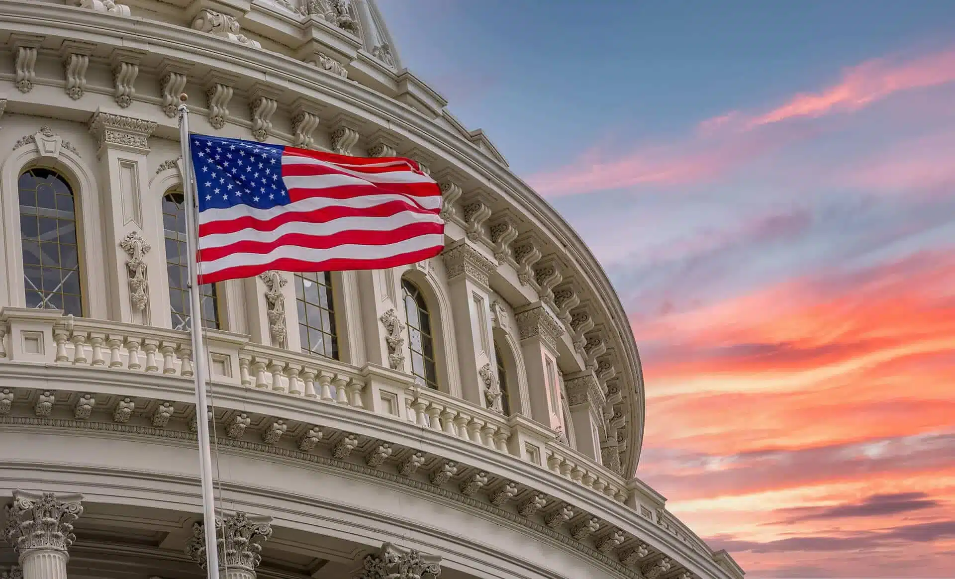
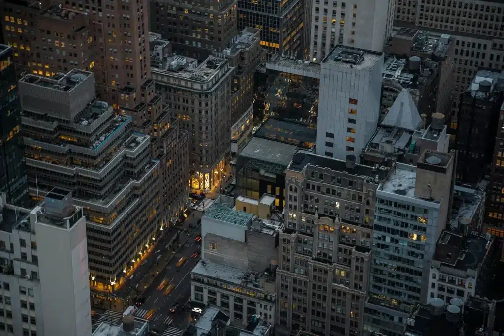
New York City features 339 remarkable neighborhoods that paint a rich tapestry of culture, history, and community. The early 19th Century marked the beginning of these distinct areas that shaped the city’s identity. Brooklyn Heights stands as America’s first suburb, while newer communities like Little Yemen in The Bronx add to the city’s evolving story.
This piece helps you navigate the city’s varied districts. Chelsea’s artistic atmosphere comes alive through its High Line, and Chinatown’s 150-year-old streets pulse with cultural energy. Our detailed exploration reveals the Upper East Side’s Museum Mile and the Lower East Side’s dynamic nightlife scene. Each neighborhood brings its unique character to New York’s vibrant landscape (Be sure to book the right transportation to see it all!)
How New York City Neighborhoods Formed
The first humans made their way to what we now call New York City about 9,000 years ago. Archeologists have found advanced hunting tools from these early settlers, with nearly 8,000 early encampments scattered across the city.
Early settlement patterns
The Lenape people built the first permanent settlements and used slash and burn techniques to cultivate their fields. Their successful farming methods helped them maintain larger populations than nomadic groups. When Europeans first arrived, they lived across 80 settlement sites in the New York City area.
Dutch settlers landed in 1613 and built a trading post on Manhattan’s western shore. The Dutch West India Company built Fort Amsterdam in 1624, which marked the start of permanent European settlement. A small community called New Amsterdam grew near the fort, where company troops and Walloon, French, and Flemish Huguenot families made their home.
Immigration waves
The city’s story as an immigrant hub really took shape in the mid-19th century. The Great Irish Famine brought waves of Irish immigrants between 1845 and 1850, and they made up one-quarter of the city’s population by 1850. Immigration from Europe surged after the Civil War, and New York became the main gateway for millions seeking a better life in America.
The immigrant population in the city reached its peak at 41% in 1910. This number dropped to 18% by 1970 but has more than doubled since then. Ellis Island saw over 11,000 immigrants arrive in a single day in 1907. More than 12 million people came through Ellis Island between 1892 and 1954.
Today’s New York has over 3 million immigrant residents, about 40% of the city’s population. The city is home to America’s largest communities of Bangladeshi, Colombian, Chinese, Dominican, Ecuadorian, Ghanaian, Guyanese, Haitian, Indian, Irish, Italian, Jamaican, Jewish, Nigerian, Pakistani, Russian, Senegalese, and Ukrainian descent.
Industrial growth impact
The Industrial Revolution altered the map of New York’s neighborhoods. Factories needed large workforces, so workers and their families settled nearby. Most Americans lived in rural areas before 1920. The 1920 U.S. Census showed for the first time that more than 50% of people lived in urban areas.
Rapid railroad expansion in the 1870s let manufacturing thrive beyond waterfront locations. Industrial centers previously needed water access, such as East Coast ports or Great Lakes locations. The railroad network helped inland cities join in manufacturing and trade.
This industrial boom created big challenges. Workers lived in cramped, dark tenement buildings. Cities grew too fast, leading to overcrowding, poor infrastructure, and diseases like tuberculosis spread rapidly. Cities started health departments as they learned more about public health. These departments worked to reduce preventable illnesses through better sanitation, hygiene, infrastructure, housing, food and water quality, and workplace safety.
The industrial sector remains crucial to New York’s economy, providing jobs to more than 530,000 people – 15.4% of the city’s private sector workforce. These industrial jobs are a great way to get economic opportunities, with median wages of $50,400 yearly, and 63% of these jobs don’t require a college degree.
These patterns of settlement, immigration, and industrial growth have shaped how New York’s neighborhoods look today. Each new wave of arrivals has added to the city’s cultural mosaic, while industrial development has influenced where and how communities grew.
Manhattan’s Downtown Districts
Downtown Manhattan bustles with 402,208 residents. The median age here is 38 years, and residents earn an average of $94,657 annually. Three unique neighborhoods make up this vibrant area.
Financial District basics
FiDi sits at Manhattan’s southern tip. The West Side Highway, Chambers Street, Brooklyn Bridge, and the East River mark its boundaries. New York City started here in 1624. Major financial institutions like the New York Stock Exchange and Federal Reserve Bank call this district home.
The NYSE runs on powerful infrastructure. It needs 3,500 kilowatts of electricity and 8,000 phone circuits on its trading floor. About 200 miles of fiber-optic cable run underground. Tourists love visiting landmarks such as Trinity Church, Federal Reserve gold vaults, and the famous trading floor.
Renters pay at least $3,200 monthly for one-bedroom apartments in FiDi. This professional hub by day becomes a peaceful residential area at night. The Battery offers waterfront fun with its SeaGlass Carousel and beautiful perennial gardens spanning 200,000 square feet.
SoHo and Tribeca lifestyle
SoHo, which means “South of Houston,” stands out with its cast-iron buildings and rich artistic history. One-bedroom apartments start at $3,500. High-end boutiques, art galleries, and trendy cafes fill these historic structures.
Tribeca (“Triangle Below Canal Street”) offers an exclusive vibe with one-bedroom rentals starting at $4,000. Wealthy professionals and celebrities now live in what used to be industrial warehouses. Residents enjoy outdoor activities at Hudson River Park and find quiet moments at Washington Market Park.
East Village culture
Creative energy flows through the East Village’s diverse streets. One-bedroom apartments here start from $2,500, making it more affordable than nearby neighborhoods. The area keeps its rebellious spirit from its 1970s punk rock days.
Little Ukraine lies between 6th and 7th Streets, from 1st to 3rd Avenues. World War II veterans created this community. The neighborhood now features 39 legal community gardens, which grew from local efforts in the 1970s. St. Marks Place – East 8th Street’s three-block stretch between 3rd Avenue and Avenue A – never sleeps.
Entertainment options abound here. McSorley’s, a 169-year old saloon, holds the record as New York City’s longest-running bar. Veselka has served Ukrainian dishes since 1954. Great Jones Spa attracts visitors with its water lounge.
New York City’s ethnic diversity shines through the local food scene. Avenue C has seen new life after the pandemic. Secret bars require visitors to ring bells for entry. Vintage shopping thrives here, with the city’s biggest collection of second-hand clothing stores.
Young people shape the neighborhood’s character. NYU students and young professionals make the East Village their home. New bars, restaurants, and shops keep popping up next to longtime favorites.
Brooklyn’s Popular Areas
Brooklyn’s two most popular neighborhoods each have their own unique character that attracts both residents and visitors. These areas combine historic architecture with modern amenities to create spaces where creativity thrives.
Williamsburg highlights
Williamsburg has become Brooklyn’s hub of artistic expression. One-bedroom apartments here cost $3,692 per month, showing how desirable the area has become. The area’s transformation from industrial roots to cultural hotspot started in the 1970s after manufacturing jobs moved elsewhere.
Bedford Avenue serves as the neighborhood’s beating heart. Small local businesses fill the streets among high-end galleries and multi-million-dollar apartments. The food scene boasts Michelin-starred restaurants – chef Missy Robbins runs two popular Italian spots: Lilia near McCarren Park and Misi on Kent Avenue.
Housing choices range from vinyl-sided two-story homes on tree-lined streets to waterfront high-rise condos. The median sale price is $1,325,000, but the area keeps its creative spirit through:
- Art galleries and exhibition spaces
- Live music venues like Brooklyn Steel and Pete’s Candy Store
- Independent boutiques and vintage clothing stores
- The Brooklyn Brewery, which offers craft beer experiences
The L Train serves as the retail hub’s lifeline, with J, M, and Z trains connecting South Williamsburg to Manhattan. McCarren Park gives residents space for recreation and community gatherings.
DUMBO features
DUMBO (Down Under the Manhattan Bridge Overpass) stands as Brooklyn’s priciest neighborhood. This former industrial area houses 25% of New York City’s technology firms, making it the city’s largest tech hub.
The area’s rise began when developer David Walentas bought two million square feet in Fulton’s Landing. His vision turned forgotten buildings into modern spaces. New luxury developments soon followed:
- One Main Street
- One John Street
- 51 Jay Street
- Front and York
- 98 Front Street
Cobblestone streets and converted warehouses create an industrial-chic feel. Time Out Market, which opened in 2019, features 21 local vendors, and Grimaldi’s Pizza remains a neighborhood icon.
The waterfront acts as DUMBO’s shared front yard, with stunning Manhattan skyline views. Popular spots include:
- Jane’s Carousel – restored by Jane Walentas as a gift to the community
- St. Ann’s Warehouse – an advanced performance venue
- Empire Stores – a Civil War-era coffee warehouse now turned retail space
- The DUMBO Archway – home to art exhibitions and the Brooklyn Flea every Sunday
Office space costs $25 per square foot, which attracts startups that can’t afford Manhattan. Companies such as Etsy and West Elm have their headquarters here. The area’s tech focus has earned it the nickname “center of the Brooklyn Tech Triangle”.
The space between the Brooklyn and Manhattan bridges offers much beyond great views. Foragers Market serves as the local grocery hub, while Front Street General provides clothing, jewelry, and household items. Historic architecture, modern amenities, and waterfront access blend perfectly to attract both residents and businesses.
Queens Neighborhood Guide
Queens is New York City’s largest borough with a mixture of neighborhoods that combine cultural diversity and residential charm. Astoria and Long Island City stand out as two districts that show the borough’s ongoing transformation.
Astoria overview
You’ll find Astoria in Queens’ northwest corner, right across from Manhattan’s Upper East Side. Pre-war multi-family buildings dominate the area’s landscape while new condos rise near the waterfront. Tree-lined streets feature single-family homes with beautiful rose gardens that add distinct character.
N and W trains serve as vital connections along 31st Street. The M and R trains link the eastern section. Local businesses thrive in commerce corridors that stretch several blocks from each subway stop. A ferry stop connects residents to Roosevelt Island and several Manhattan locations.
Food lovers head to 30th Avenue to sample everything from traditional Greek taverna dishes to delicious crepes. Steinway Street’s boutique furniture stores and clothing shops extend to the big-box retailers on Northern Boulevard.
The neighborhood’s cultural attractions include:
- Museum of the Moving Image – celebrating film and television history
- Kaufman Movie Studios – a historic production facility
- Socrates Sculpture Park – featuring waterfront art installations
- Bohemian Beer Hall – one of New York City’s oldest drinking establishments
Residents find peace at Astoria Park beneath the RFK Bridge. The park has the city’s largest public pool. Summer evenings bring locals together for free concerts that showcase the neighborhood’s community spirit.
Long Island City basics
Long Island City sits south of Astoria, facing Brooklyn’s Greenpoint district across Newtown Creek. The area started as an independent city with its own mayor in the 1870s before joining New York City in the late 1890s. This former industrial hub continues its transformation into a residential destination.
Modern luxury high-rises cluster near Queensborough Plaza and the waterfront. Brick-faced multi-family buildings from the late 1800s fill the inland areas. At $3,793 monthly, the median rent makes this Queens’ priciest rental market.

The neighborhood’s transportation network includes:
- N and W trains converging with the 7 line at Queensboro Plaza
- G, E, M, and R trains at various stations
- Ferry services offering quick Manhattan access
Vernon Avenue buzzes with restaurants, bars, and breweries. Center Boulevard at Hunter’s Point boasts a thriving waterfront dining scene. Cultural spots enrich the area:
- MoMA PS1 – a renowned contemporary art museum
- Gantry Plaza State Park – offering Manhattan skyline views
- Socrates Sculpture Park – an outdoor museum featuring contemporary installations
Young professionals flock here seeking easy access to Midtown Manhattan. The iconic Pepsi-Cola sign has watched over the waterfront since 1936. Places like Manducati’s Rustica and LIC Bar keep old-school charm alive amid rapid changes.
These neighborhoods show Queens’ talent for balancing growth with community spirit. Astoria keeps its middle-class character while Long Island City grows into a luxury hotspot. Together, they show how Queens neighborhoods can evolve while keeping their unique identities.
Transportation Between Areas
New York City’s neighborhoods need a well-connected transportation network. The public transit system never stops and gives people many ways to travel between boroughs, but if you have a large bus, you might want to consider a charter bus to New York City’s best sights.
Subway connections
New York City’s subway system acts as the city’s lifeline. It links Manhattan, The Bronx, Brooklyn, and Queens through 472 stations. Trains come every 2-5 minutes during rush hours (6:30 a.m.-9:30 a.m. and 3:30 p.m.-8:00 p.m.). Service runs every 5-15 minutes at other times.
The fare system is simple:
- Single ride: $2.90 via OMNY contactless payment
- SingleRide ticket: $3.25
- 7-day unlimited pass: $33
Passengers can switch between subway lines at no extra cost if they stay inside the turnstiles. The Interborough Express connects with 17 subway lines and gets riders from end to end in under 40 minutes. Weekday ridership reaches 115,000 passengers.
Bus routes
The MTA runs 80 express bus routes throughout New York City. Buses fill vital gaps where subways don’t reach. Local bus rides cost $ 2.90, and riders can pay with MetroCard, SingleRide tickets, OMNY payments, or exact change.
Select Bus Service (SBS) routes help optimize transit:
- 16 routes now run citywide
- Fordham Road-Pelham Parkway route is 20% faster
- 98% of riders are satisfied
Ferry services
New York City Ferry links waterfront areas in all five boroughs. America’s largest passenger fleet has 38 vessels. Boats run every 20 to 90 minutes based on the season.
Riders can choose from these tickets:
- Adult One-Way Pass: $4.00
- 10-Trip Pass: $27.50
- Seniors/disabled passengers: $1.35
- Children under 44 inches: Free
Staten Island Ferry offers free service around the clock between South Ferry Terminal and St. George Terminal. Other ferry companies serve specific routes:
- Liberty Landing Ferry: World Financial Center to Jersey City
- NY Water Taxi: Pier 11 to IKEA Brooklyn
- Seastreak: Monmouth County to New York City
New York City Ferry app tickets work for 90 days. Passengers can transfer free within the system for 120 minutes after starting their trip. The network helps people:
- Get to work
- Visit outdoor spaces
- Access cultural spots
- Reach fun destinations
The transportation system keeps growing. The MTA wants all-electric buses by 2040 and has set aside $1.10 billion for 500 electric vehicles. This complete network helps people move between neighborhoods easily, supporting the city’s growth and its residents’ lifestyle.
Charter Bus
Navigating New York City with a big group can be challenging, but Metropolitan Shuttle makes it easy with New York City charter bus rentals designed for comfort, convenience, and efficiency. Instead of dealing with crowded subways, multiple rideshares, or the hassle of coordinating individual transportation, a private charter bus keeps your group together while providing stress-free, direct transportation to your destinations. Whether you’re exploring iconic landmarks like Times Square and Central Park, attending a corporate event, or heading to a Broadway show, Metropolitan Shuttle offers spacious, climate-controlled buses with professional drivers who expertly navigate New York City’s busy streets. With custom pickup and drop-off locations, your group can travel seamlessly across boroughs, making your New York City experience smooth, enjoyable, and hassle-free.
Choosing Your Neighborhood
New York City’s neighborhood selection needs a careful look at several key factors. A 2023 survey shows that 50% of New York City residents focus on three main things: budget, commute time, and lifestyle priorities.
Budget considerations
Your monthly rent shapes where you can live in New York City. Landlords typically want tenants whose yearly income is 40 times the monthly rent. A $2,000 monthly apartment means you need to earn $80,000 yearly.
Rent costs vary a lot between boroughs:
- East Village: One-bedroom apartments start at $2,500
- Williamsburg: Average one-bedroom costs $3,200
- Brooklyn Heights: Monthly rentals begin at $2,000
- Astoria: Studios range from $1,000 to $2,000
Your budget should include utility costs, security deposits, and moving expenses. New York City’s housing market shows that more than half of renters spend over one-third of their income on housing.
Commute factors
New York City residents spend 36 minutes on average getting to work. Travel times differ based on where you live:
- Starrett City, Brooklyn: 64-minute average commute
- Hammels-Arverne-Edgemere, Queens: 61-minute trip
- Co-Op City, Bronx: 56-minute travel time
The subway system connects 472 stations through 27 train lines. Your daily commute depends on:
- Distance to nearest subway station
- Number of train transfers needed
- Service reliability
- Alternative transport options
Living a few blocks from transit can save you money on rent. New York City’s bike-sharing program and ride-sharing services give you more ways to get around.
Lifestyle match
Each area in New York City offers its own unique living experience. PlaceILive helps match people with their ideal neighborhoods by analyzing 289 areas using nine lifestyle criteria. Their Life Quality Index looks at:
- Exercise opportunities
- Grocery access
- Weekend activities
- Community atmosphere
- Cultural resources
- Safety statistics
- School quality
- Healthcare facilities
- Park proximity
Newcomers should visit potential neighborhoods at different times:
- Early morning rush
- Late evening atmosphere
- Weekend activity levels
Community District Needs statements show what each area wants to improve. These reports detail:
- Infrastructure improvements
- Service delivery plans
- Development projects
- Public space initiatives
Local Community Boards shape neighborhood planning through:
- Budget request submissions
- Infrastructure recommendations
- Service delivery feedback
City agencies work directly on these community priorities. Understanding an area’s development plans helps you predict future changes.
New York City’s Department of City Planning focuses on creating affordable housing, protecting tenants, and involving communities in neighborhood development. Current programs target:
- Anti-harassment measures
- Tenant outreach programs
- Safety improvement plans
- Cultural resource preservation
Your ideal neighborhood should be close to:
- Healthcare facilities
- Educational institutions
- Grocery stores
- Parks and recreation
- Cultural venues
New York City’s housing options include nearly 1 million rent-regulated units and 175,000 public housing apartments. These homes help residents find stable, affordable living spaces.
Local Life Essentials
The quality of life in New York City’s neighborhoods depends heavily on daily necessities. Each area offers different essential services that shape how residents live their everyday lives.
Grocery shopping
New York City residents can choose from many food shopping options ranging from major supermarket chains to small local stores. Trader Joe’s, Whole Foods, Key Food, Stop & Shop, and ShopRite serve customers throughout the five boroughs. Local neighborhoods feature:
- Fruit markets and specialty shops
- Ethnic food stores and delis
- Year-round farmers’ markets
- Local bodegas and corner stores

The Union Square Greenmarket lets SNAP beneficiaries exchange their food stamps for tokens. Grocery prices vary by location:
Brooklyn and Queens Food Bazaar supermarkets charge less than Manhattan stores. Trader Joe’s remains budget-friendly, and street vendors sell affordable fresh produce. Harlem residents can shop at low-cost chains like Aldi and Lidl.
Food deserts now have online options. Fresh Direct, Instacart, and Amazon Fresh bring groceries right to your door. Many supermarkets have launched their own delivery apps.
Healthcare access
New York City’s healthcare facilities spread unevenly. Manhattan employs twice as many healthcare workers per 100 residents as the Bronx, Queens, and Staten Island. Primary care remains limited with all but one of these 450 facilities located in Manhattan and Brooklyn.
Brooklyn shows clear healthcare gaps:
Black neighborhoods have 50 staffed hospital beds per 100,000 residents. Hispanic areas have just 36 beds per 100,000 residents. The entire borough averages 112 beds per 100,000 people.
Healthcare worker salaries affect what patients pay:
- Doctors earn $165,000 annually
- Registered nurses make $98,440 yearly
- Licensed practical nurses receive $56,600 per year
Brooklyn residents often leave the borough for medical care. One-third sought treatment elsewhere in 2021. More than half of commercially insured patients went outside Brooklyn. Medicaid patients stayed local more often, with only 28% traveling for care.
Schools nearby
School quality differs greatly between neighborhoods. The Upper East Side features elite private schools:
- Dalton School ranks 10th among U.S. K-12 schools
- Brearley School stands as America’s 2nd best all-girls high school
- Chapin School ranks 5th among U.S. all-girls high schools
Brooklyn Technical High School serves as the borough’s educational life-blood, ranking 3rd nationwide among standout high schools. The Upper West Side boasts prestigious options:
- Trinity School ranks 2nd among America’s K-12 private schools
- Columbia Grammar & Prep holds the 87th spot nationally for K-12 private schools
Chelsea’s educational landscape includes:
- New York City Museum School ranks 19th among standout high schools
- Baruch College Campus High School holds 25th place
- PS 11 William T. Harris performs in New York City’s top 7% of elementary schools
The Bloomberg administration works with NYU’s Furman Center and the U.S. Census Bureau to track neighborhood data. This helps families find areas matching their educational needs. As one administrator noted, “Most people would value safety over access to cool bars; public schools may be very important to some and not at all to others”.
Safety and Community
Public safety plays a big role in shaping how New York City’s five boroughs function. New data shows major shifts in crime patterns and how communities work with law enforcement.
Crime statistics
New York City neighborhoods have seen steady improvements in crime rates. Violent crime has dropped to record lows since 1990. The biggest problem remains in public housing – just 15 developments make up 20% of all violent crime in city housing.
The city sees about 46 crimes per thousand residents. One in 26 residents faces property crimes. Your chances of becoming a violent crime victim are:
- 1 in 129 in Manhattan
- 1 in 257 across New York State
- 77,893 total reported crimes each year
The Mayor’s Action Plan for Neighborhood Safety (MAP) tackles these issues head-on. The plan started in 2014 and targets 15 developments with New York City’s highest disadvantage rates.
Community boards
Community boards give neighborhoods a voice in local government decisions. These boards can have up to 50 volunteers, appointed by borough presidents. City Council members nominate half the members from their districts.
The boards help shape neighborhoods by working on:
- Housing policies
- Street designs
- City service oversight
- Public space plans
New York City’s 1975 Charter revision created:
- 59 Community Districts/Boards
- District manager roles
- Uniform Land Use Review Procedure
Recent studies show these boards don’t always reflect their neighborhoods. Many have too many older, white, male members. Car owners often outnumber transit riders, which affects transportation planning.
Residents meet with city agencies through NeighborhoodStat meetings. These meetings build trust between locals and the government. People work together to fix:
- Public safety concerns
- Quality of life issues
- Infrastructure needs
- Service gaps
The Office of Neighborhood Safety runs several programs to help affected communities. Their work shows promise – MAP developments saw 7% fewer index crimes over six years. Other areas without MAP saw crimes go up by 1%.
Community boards weigh in on key decisions about:
- Restaurant liquor licenses
- Street safety improvements
- Curbside reform
- City-wide projects
While board decisions are just advisory, city agencies usually follow their advice. This local input helps New York City neighborhoods become safer and more vibrant places to live.
Conclusion
New York City’s 339 neighborhoods each tell their own unique story. These areas show amazing diversity through their distinct personalities and communities. The Financial District shows its economic muscle while Williamsburg radiates artistic energy. Getting around is easy thanks to the city’s massive transit system that connects all these different areas.
Downtown Manhattan perfectly mixes old-world architecture with modern comforts. Brooklyn’s hotspots have found the sweet spot between creative energy and peaceful living. Queens shows how neighborhoods can evolve while keeping their cultural roots strong.
Your perfect neighborhood comes down to three things: what you can afford, how you’ll get to work, and the lifestyle you want. Each area differs by a lot when it comes to basics like grocery stores, medical care, and schools. The local community boards team up with police precincts to keep neighborhoods safe and tackle what residents care about.
You should check out several neighborhoods before you decide. Take time to visit these areas at different hours and chat with people who live there. Try out your future commute route. Most importantly, see how each neighborhood’s vibe fits your lifestyle and budget.
New York City keeps growing and changing. These neighborhoods hold onto their unique character. Shaped by hundreds of years of immigration and growth, these communities have something for everyone – from peaceful residential streets to lively cultural spots.
FAQs
Q1. How many boroughs make up New York City?
New York City consists of five boroughs: Manhattan, Brooklyn, The Bronx, Queens, and Staten Island. Each borough has its own unique character and attractions, contributing to the city’s diverse landscape.
Q2. What factors should I consider when choosing a neighborhood in New York City? When selecting a neighborhood in New York City, consider your budget, commute time, and lifestyle preferences. Other important factors include access to public transportation, local amenities, safety statistics, and the overall community atmosphere.
Q3. Which New York City neighborhoods are known for their cultural diversity?
Many New York City neighborhoods are celebrated for their cultural diversity. Some notable examples include Jackson Heights in Queens, known for its mix of South Asian and Latin American communities, and Flushing, which has a large Asian population. The Lower East Side in Manhattan also has a rich history of immigrant communities.
Q4. How does public transportation connect different New York City neighborhoods?
New York City’s extensive public transportation system includes subways, buses, and ferries that connect various neighborhoods. The subway system is particularly comprehensive, with 472 stations across 27 train lines, operating 24/7 and serving all five boroughs.
Q5. What role do Community Boards play in New York City neighborhoods?
Community Boards in New York City serve as local representative bodies that advise on issues affecting their districts. They influence decisions on zoning, land use, and budgeting, and provide a platform for residents to voice concerns about neighborhood matters such as education, safety, and development projects.